Chester County, Pennsylvania · Our story

American history.
Home ground.

Before the county lines. Through the fight for independence. From the farmer’s field to the furnace floor.

This corner of Pennsylvania has helped feed, forge and move a nation. Get to know the people, the struggles and the extraordinary everyday work that made Chester County.

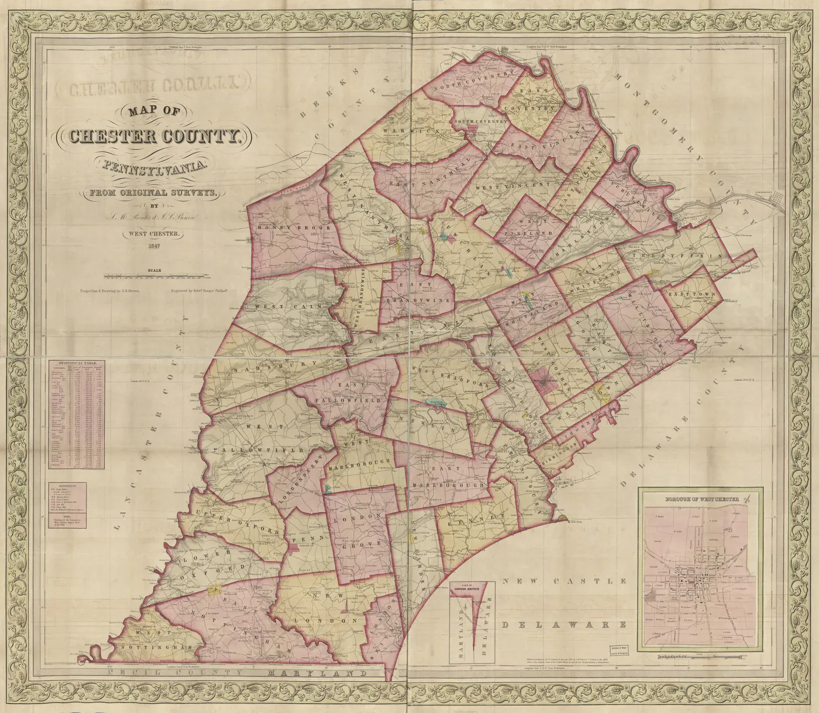
Hand-colored map of Chester County divided into townships, with rural buildings and a separate inset map of West Chester.
An 1847 county map from original surveys, showing township boundaries, rural buildings and householders' names; larger property tracts are identified in the West Chester inset. Image credit

Eight chapters. Countless connections.

Find your way into the past.

Choose an era, linger over an old photograph, or follow a thread through time. These chapters overlap: farming, invention and the pursuit of freedom never belonged to just one century.

Before colonial boundaries–presentChapter 01

Lenape homelands, living Nations

Long before Chester County had a name, Lenape people knew this land through its rivers, seasons, communities, and relationships. That history is still living.
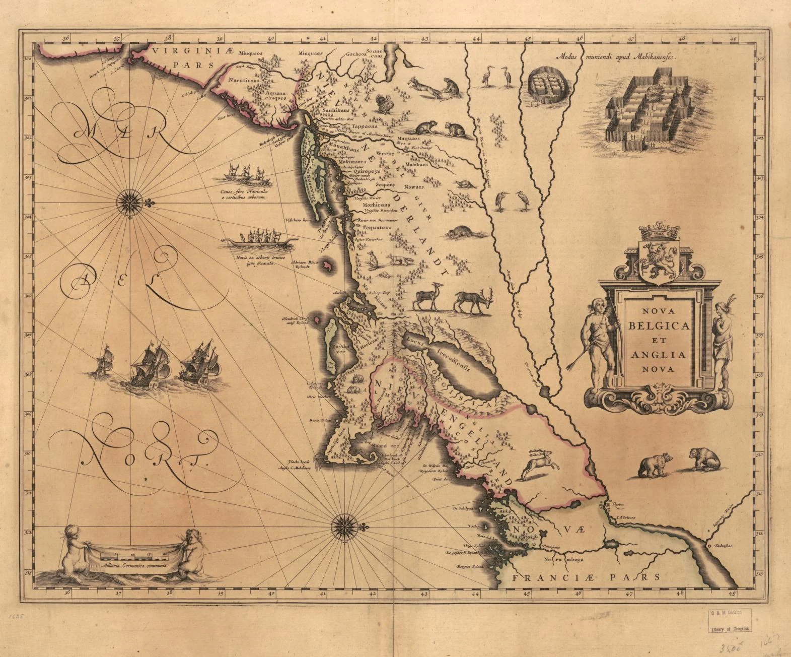
Ornate hand-colored map of New Netherland and New England, with coastlines, river corridors, ships, animals, and place names; the map is oriented with north to the right.
Willem Janszoon Blaeu’s 1635 Nova Belgica et Anglia Nova places the Delaware River region within a European map of New Netherland and New England, decades before Chester County formed. The names and north-right orientation reflect a colonial cartographer’s view, not Lenape cartography. Image credit

Follow the water, before you follow the roads

Start with the water. The Brandywine, French Creek, and the streams flowing toward the Schuylkill belong to a Delaware Valley story much older than a township map. Eastern Pennsylvania is part of Lenape ancestral homelands. Communities farmed, fished, hunted, traveled, and traded here, sustaining relationships with neighboring peoples across a landscape of river valleys and woodland. Lenape means “the people.” This was a peopled homeland, with knowledge, leadership, and diplomacy already deeply rooted when Europeans arrived.

Dutch, Swedish, and Finnish settlements and trading posts preceded William Penn’s English Quaker colony in the Delaware Valley. Lenape people participated in trade and negotiated with newcomers; they were actors in this changing world. European officials often expected a single leader to speak for everyone, while Lenape authority and community relationships were more varied. Trade, negotiation, and settlement did not mean the same thing to every participant, especially when colonial deeds converted relationships with land into exclusive ownership.

Colonial expansion brought profound losses. In the 1737 Walking Purchase, the Penn family used a manipulated day-and-a-half walk to assert a vast land claim in eastern Pennsylvania. The episode became a lasting example of dispossession, followed by further removals and broken agreements that pushed many Lenape people westward. This wider regional history reaches beyond today’s Chester County boundary, but it belongs at the beginning of any honest account of the place.

The story continues through living Nations and families. Delaware Nation and Delaware Tribe of Indians in Oklahoma, Stockbridge-Munsee Community in Wisconsin, and Lenape First Nations in Ontario preserve distinct histories, languages, and political identities. Their own voices help us understand both the homeland and the experience of removal. To know Chester County well is to recognize this enduring connection alongside the farms, towns, and roads that came later.
1682–1776Chapter 02

A county takes shape

One of Pennsylvania’s three original counties grew through farming, Quaker meeting communities, trade, and the work of households connected to Philadelphia.

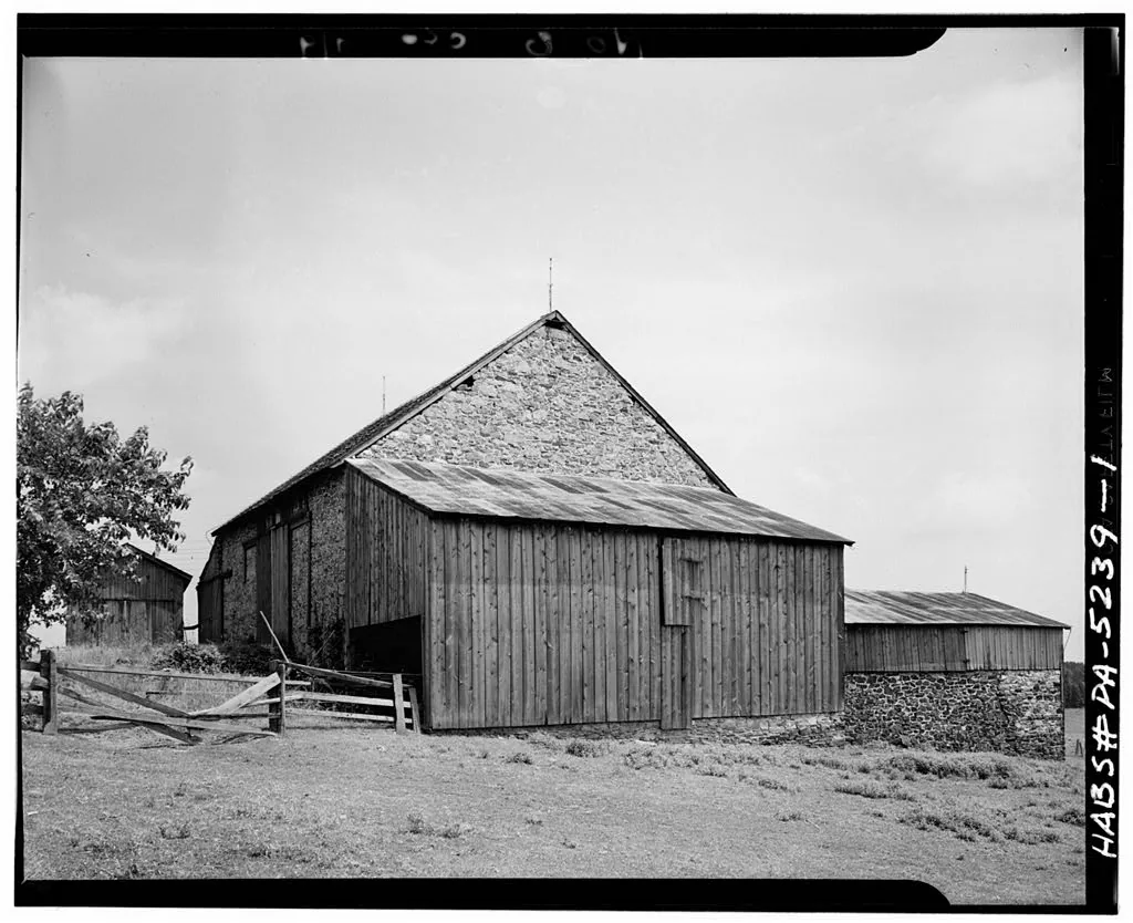
Black-and-white photograph of a stone bank barn with timber additions, a fenced yard, and outbuildings near Kaolin.
An eighteenth-century bank barn at Kaolin, New Garden Township, preserved in a later survey photograph by Charles H. Dornbusch. Image credit

A world of farms, meetinghouses, and mill wheels

Chester County took its place on Pennsylvania’s map in 1682, alongside Bucks and Philadelphia. That first county was much larger than the one we know. In December, Pennsylvania’s first Assembly met at historic Upland—renamed Chester, now in Delaware County. The new institutions of Penn’s colony took shape on Lenape homelands, bringing another system of courts, land titles, and government to an already inhabited region.

English and Welsh Quaker families were prominent among the settlers, joined by German-speaking and other European migrants. Meeting communities, farmsteads, roads, and villages spread through the countryside. Religious practice and ordinary work were closely connected: a household’s life depended on its land, its neighbors, and the routes that carried goods to market. The surviving meetinghouses and stone farm buildings make this early county tangible, even where a busy road now runs past the door.

Grain tied the countryside to Philadelphia. A mill turned a harvest into flour that could feed households and enter a wider market; a stream supplied the power. At Mount Pleasant on French Creek, milling began by the 1730s. The mill that survives there was built around 1805, carrying that earlier relationship between water and agriculture into a new century. Farms and mills helped make southeastern Pennsylvania a productive region, with skilled work and exchange connecting places that can look quiet on an old map.

The county’s geography kept changing. Lancaster County separated in 1729, the county seat moved to West Chester in 1786, and Delaware County separated in 1789. West Chester’s later role as a courthouse town grew from that westward shift. A familiar county name in an early document can therefore describe a much wider place than it does today.

The promise of religious liberty coexisted with unfree labor. Enslaved people lived and worked in Chester County, and indentured servants could be bound to years of service. Surviving complaints, manumissions, and slave registers preserve traces of their lives. Pennsylvania’s gradual abolition law arrived in 1780, after independence had been declared, and did not immediately free those already enslaved. The work of making liberty real would continue across generations.

1777–1778Chapter 03

Independence, close to home

In 1777–78, the fight for American independence moved through this countryside. Defeat, endurance, training, and international support all shaped what came next.

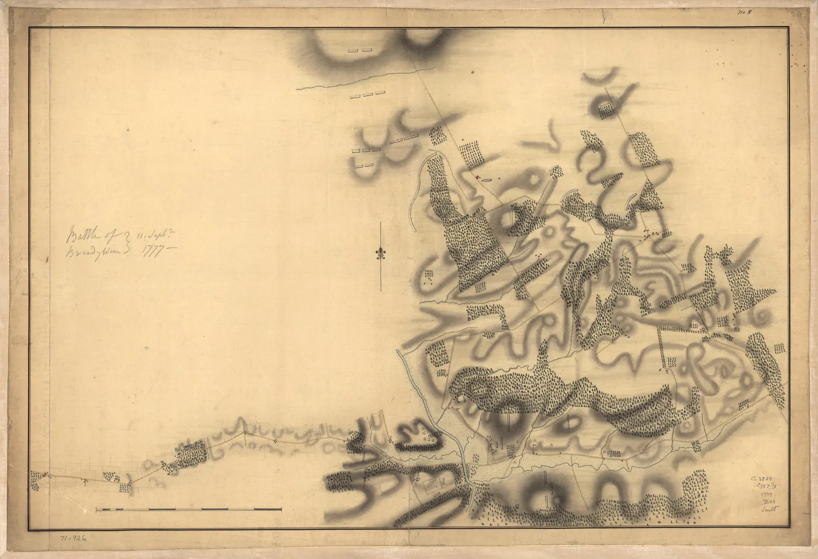
Hand-drawn campaign map showing roads, waterways, and military positions near Chadds Ford during the Battle of Brandywine.
John Montrésor's unfinished manuscript map of the Battle of Brandywine near Chadds Ford, September 11, 1777. Image credit

Brandywine. Clouds. Paoli. Valley Forge.

In September 1777, General William Howe’s British army advanced toward Philadelphia, the American capital. George Washington placed his Continental Army along the Brandywine to block its approach. On September 11, British and Hessian troops pressed the American position while a column led by Charles Cornwallis made a wide flanking movement. The attack struck the American right and forced a retreat. Brandywine was a British victory, but Washington’s army survived to continue the campaign. The battlefield extends across a landscape now divided between Chester and Delaware Counties, including present-day Chadds Ford.

Five days later, the armies approached another confrontation near present-day Malvern. Then the weather transformed the Battle of the Clouds. Heavy rain soaked powder and made sustained fighting impossible. Washington withdrew through Yellow Springs and farther north, where ironworks and military supplies needed protection. A campaign was also a struggle over roads, food, ammunition, and the ability to keep an army moving. Farms and mills became part of that military geography, and civilians lived with the consequences of passing armies.

On the night of September 20–21, British troops under Charles Grey struck Anthony Wayne’s camp near Paoli. Wayne was a Chester County native, born in Easttown, fighting close to home. Grey ordered a bayonet attack, and the surprise inflicted heavy American losses. Patriots remembered the encounter as the Paoli Massacre. Its memory endured in the county long after the armies moved away. Brandywine and Paoli were painful reverses in a war whose outcome remained uncertain.

The British occupied Philadelphia later that September. On December 19, Washington’s army entered winter quarters at Valley Forge, a position close enough to watch the occupied city while controlling important approaches. Soldiers built huts and fortifications. Food, clothing, disease, and supply failures posed grave challenges. Women, children, civilian workers, free and enslaved Black people, and Indigenous people were part of the encampment’s human world. Valley Forge was an encampment, not a battle; the national park today spans Chester and Montgomery Counties.

The camp also became a place of improvement. Friedrich Wilhelm von Steuben arrived in February 1778 and helped standardize training across units from different states. Soldiers practiced coordinated movement and weapons handling, while officers learned a common system of instruction. On May 6, the army celebrated news of the French alliance—a powerful sign that the struggle for independence had become an international cause. When the army marched out on June 19, it carried the experience of hardship and a stronger capacity to fight together. That combination of endurance and learning is central to Valley Forge’s place in the American story.

1717–late 1800sChapter 04

Iron, cannons, and American ingenuity

From charcoal furnaces to boiler plate and Civil War artillery, Chester County’s makers helped supply a nation at war and build a nation at work.

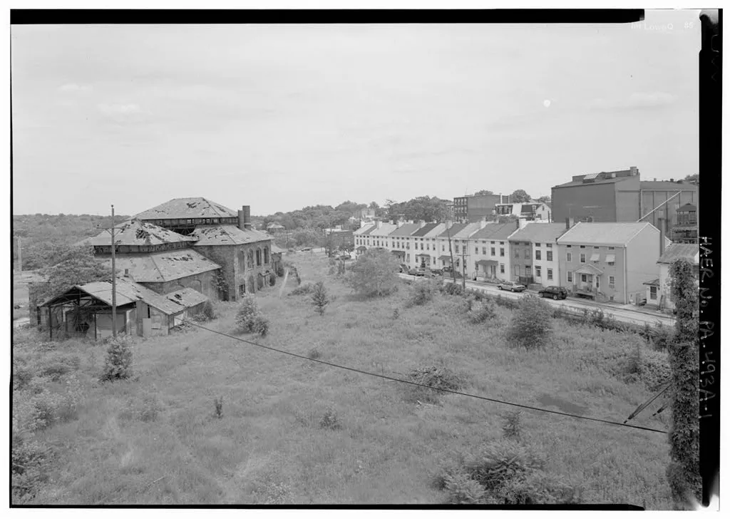
Black-and-white survey photograph looking east across a vacant lot toward the Phoenix Iron Company Foundry and adjoining buildings in Phoenixville.
Phoenix Iron’s 1882 foundry and neighboring mill-town buildings, seen from the Gay Street Bridge in a later historic survey photograph. Image credit

The sound of a working county

Ironmaking began with a whole landscape: ore, timber, water, roads, and people who knew how to use them. Coventry Forge, established in 1717, was the county’s first forge. Charcoal furnaces smelted iron; forges refined and worked it, drawing power from moving water. Woodcutters and charcoal makers supplied fuel, while teams moved raw materials and finished products. The remains of charcoal hearths in the Warwick landscape recall the labor behind a bar of iron.

During the Revolution, Warwick Furnace supplied munitions to the Continental Army. Protecting the region’s ironworks mattered to Washington as he maneuvered after Brandywine. The connection between independence and industry was practical: armies needed metal as well as men, and an ironmaking district could be a strategic resource. These Revolutionary furnaces belong to an earlier chapter than the famous Civil War cannons later made at Phoenixville.

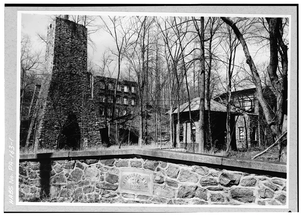
At Hibernia, Samuel Downing established a forge in the early 1790s. By 1850, the works included two forges, heating furnaces, a rolling mill, a gristmill, a mansion, and houses for workers and their families. Sixteen men and boys worked in ironmaking, supported by a broader household economy of gardens, orchards, animals, and family labor. Hibernia was a place to live as well as a place to work. Its ironworks closed in the late 1870s; the surviving landscape now helps visitors imagine that community.

Coatesville found opportunity in the steam age. Brandywine Iron Works opened in 1810, and a December 1818 ledger records boiler plate—a product essential to steam technology. When Charles Lukens died in 1825, Rebecca Lukens took responsibility for the works. She kept the business going and helped establish its reputation for reliable plate. Her story puts judgment, persistence, and a woman’s industrial leadership at the center of a county often remembered through the names of mills and machines.

Phoenixville made another kind of national contribution. During the Civil War, Phoenix Iron produced the wrought-iron 3-inch Ordnance Rifle: a rifled field cannon, despite the word “rifle” in its name. The company also developed the Phoenix Column, patented in 1862, a structural innovation used in bridges and buildings. Artillery and architecture drew on the same regional strengths—metalworking skill, engineering, and disciplined production. The foundry, the mill, and the workers’ neighborhood all belong in this story of Pennsylvania helping shape America.

1780–presentChapter 05

The continuing work of freedom

Black Chester County history is a story of families and institutions built with determination—and of Americans pressing the country to live up to its promise.

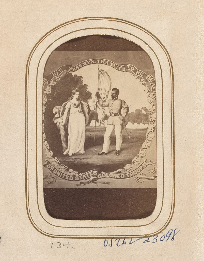
Sepia image of a Black Union soldier holding a flag beside an allegorical woman; the design bears a freedom motto and the 3rd United States Colored Troops name.
A photographic print of Philadelphia artist David Bustill Bowser’s painting of a regimental flag design for the 3rd United States Colored Troops. The motto reads ‘Rather die freemen than live to be slaves.’ This image speaks to Pennsylvania’s wider USCT history; it does not identify a Chester County soldier. Image credit

Land, learning, service, and a voice

Pennsylvania’s 1780 gradual abolition law changed the law without immediately ending slavery. Chester County’s records preserve the names of people held in bondage and the contests over their freedom. One was Phebe English, a young Black girl held in New Garden Township. In 1789, the Pennsylvania Supreme Court ruled that she and the women in her maternal line had been born free. Her case gives a name and a family history to the struggle against a claim of ownership.

Freedom also took root through land and community. Near today’s Lincoln University, Hinsonville grew as free Black residents purchased farms, supported families, and built relationships with neighbors. Tilghman Valentine bought a 16-acre farm in 1837 and later sold parcels to other Black residents. In 1843, church leaders acquired his remaining Hinsonville property. Hosanna Church survives as a reminder of a community whose achievements were made through ordinary, consequential acts: owning land, working it, and building institutions together.

Freedom remained vulnerable. In 1851, Elizabeth and Rachel Parker, free Black sisters living in Chester County, were illegally kidnapped and taken toward Baltimore’s slave market. The Fugitive Slave Act’s era made the threat of capture especially urgent, but the sisters’ kidnapping was not lawful enslavement. Their case prompted antislavery organizing and a struggle to recover them. Such experiences made resistance to slavery an immediate local concern, close to the Mason-Dixon Line.

In 1854, Ashmun Institute was chartered in southern Chester County; it later became Lincoln University, one of the nation’s earliest degree-granting institutions for Black students. During the Civil War, Black men from the county served in the United States Colored Troops and other regiments. Veterans later built civic institutions, including Coatesville’s Daniel Reed Grand Army of the Republic post. Learning, service, and organization widened the county’s public life.

Progress did not erase racial violence or segregation. In 1911, a white mob lynched Zachariah Walker in Coatesville, and all indicted perpetrators were acquitted. West Chester’s Gay Street School remained part of a segregated school system until 1956. These histories belong alongside the achievements of farmers, students, veterans, and artists such as Horace Pippin. Knowing both deepens the meaning of civic pride: the county’s story includes people who worked to make American freedom more complete.

1800s–presentChapter 06

A county that keeps growing

Agriculture is a living part of Chester County’s identity: a story of good land, nearby markets, specialized knowledge, and generations of people doing demanding work.

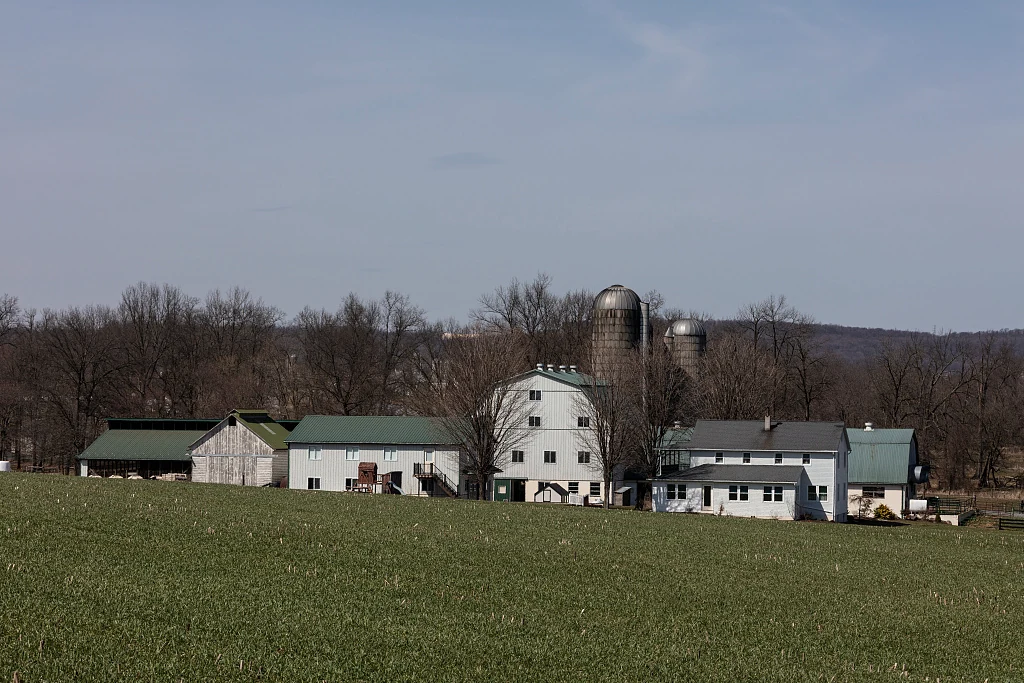
A broad green field with a barn, farmhouse, silos, and connected farm buildings in Honey Brook Township.
Carol M. Highsmith’s March 2019 photograph records an Amish family farmstead in Honey Brook Township. It is a modern example of a working county landscape, not an image of earlier farm life. Image credit

From grain fields to mushroom houses

A farm landscape is never as still as it looks. Across southeastern Pennsylvania, grain farming connected the colonial countryside to Philadelphia; later markets encouraged butter and milk, vegetables, ornamental plants, poultry, and other products. Different farms followed different paths. Changing transport and nearby customers helped shape what could be grown, sold, and sustained. The stone barn and the greenhouse belong to the same long history of adaptation.

Agriculture remains substantial alongside the county’s towns and suburbs. In the 2022 Census of Agriculture, Chester County had 1,558 farms and 143,442 acres of farmland. Those dated figures are one measure of an enduring working landscape. Behind them are businesses and households making decisions about crops, equipment, animals, labor, and the next season. Farming contributes to what the county eats, how its land looks, and how residents experience home.

Around Kennett Square, mushrooms became a defining crop. Chester County History Center connects early commercial growing to Italian stonemasons who used space beneath greenhouse flower benches. An unexpected corner of horticulture developed into an industry with specialized growing houses, packing, transport, and accumulated practical knowledge. The county’s mushroom story is a reminder that innovation can begin with making better use of space already at hand.

Growers also helped build a relationship with agricultural science. Penn State began mushroom research in the 1920s, opened a campus research facility in 1928, and expanded it in 1934 with support from the Mushroom Growers Cooperative Association of Kennett Square. Local experience and university research reinforced each other. Better understanding of cultivation became part of the region’s agricultural infrastructure, just as mills had supported an earlier grain economy.

People carried this industry forward. Italian immigrant enterprise is part of its history; Mexican migrant farmworkers have been central to Pennsylvania mushroom production since the mid-1960s. Harvesting and packing depend on skill and demanding physical work. Long-established farm families, newer immigrants, researchers, and local businesses have all helped make the county’s food economy. Pride in what grows here includes respect for the people whose work brings it to the table.

1871–presentChapter 07

New work, enduring character

Schools, studios, laboratories, and new businesses have added their own chapters to a place shaped by farms and iron.

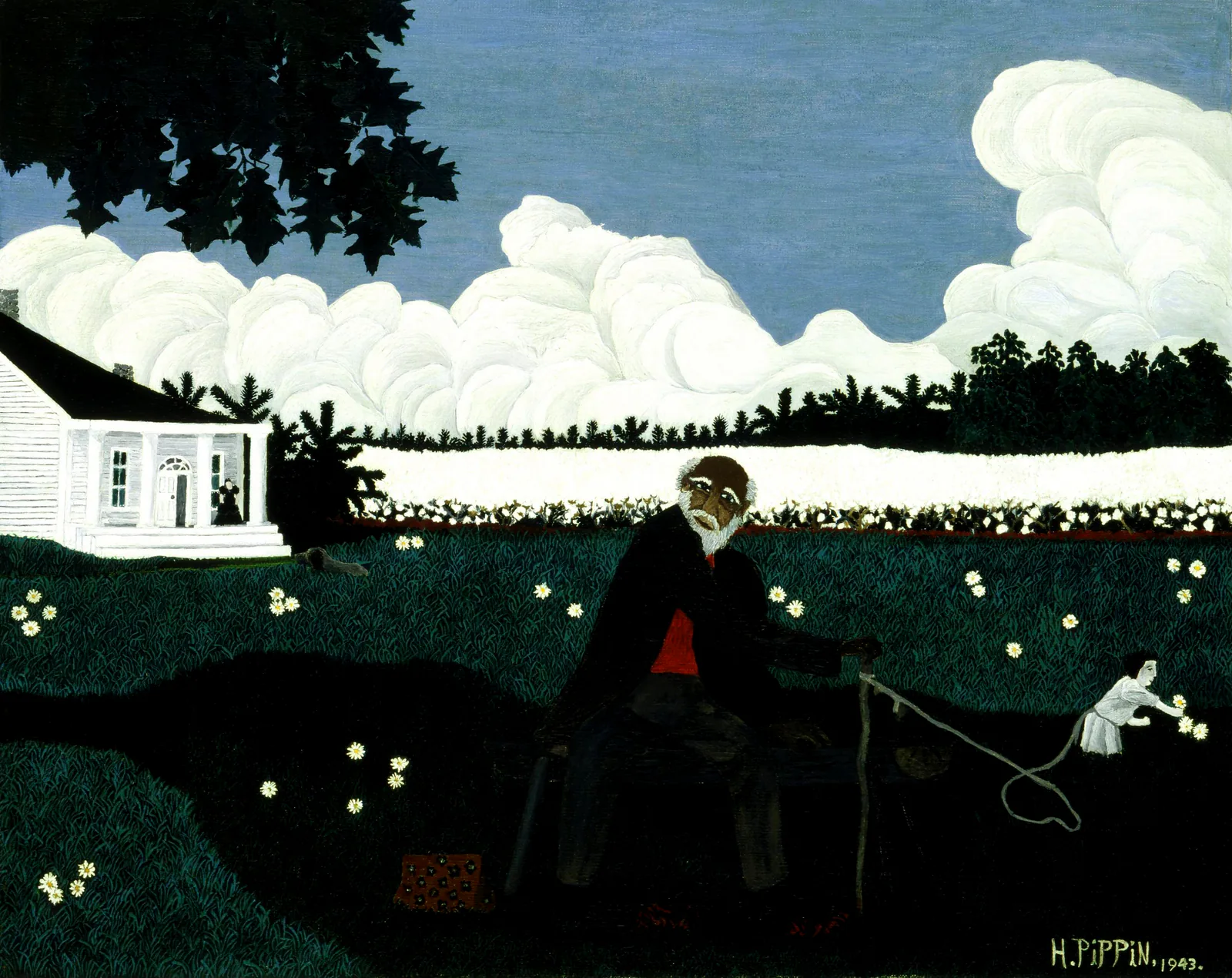
Oil painting of an older Black man in a dark field with a white child standing at right; a small house and stylized clouds fill the background.
West Chester artist Horace Pippin’s Old Black Joe (1943) challenges a nostalgic view of slavery. This imagined cotton-field scene is held by the Smithsonian American Art Museum; it does not depict Chester County. Image credit

Learning, art, and the county we know today

In 1871, West Chester’s Normal School opened to train teachers. Education became another way the county’s work reached outward: teachers carried their learning into classrooms beyond the campus. The institution grew into West Chester University, bringing generations of students and faculty into the borough. Alongside Lincoln University in the south, it gives higher education a deep local history.

Horace Pippin’s life connects West Chester to military service and American art. Born in the borough in 1888, he served in France with the 369th Infantry during World War I. A wound to his right shoulder left a lasting disability. He returned to West Chester in 1920 and developed his work as a self-taught artist. A 1937 exhibition at the West Chester Community Center helped bring him wider attention. His paintings now belong to major museum collections, including the Smithsonian.

The painting shown here, Old Black Joe, addresses slavery through an imagined scene; it does not depict a Chester County farm. Pippin brought memory, observation, and questions about American life into his art. His achievement expands the county’s story beyond what it grew or manufactured: this was also a place from which an artist could change what people saw and remembered.

The county’s economy now includes life sciences, information technology, manufacturing, agriculture and food, health care, education, logistics, and professional services. Older industrial places remain part of this geography. In Phoenixville, the surviving foundry helps tell the story of the iron company; in Coatesville, industrial heritage keeps Rebecca Lukens and generations of metalworkers in public memory. The past gives these towns a character that cannot be supplied by a new building alone.

Modern Chester County is the result of these layers of work and change. A university town, a mushroom-growing community, a former iron district, and a rural township can share a county without having the same experience of it. Preserving that variety while making room for new opportunity is part of the work of the present. The county’s strongest inheritance is a capacity to learn, make, and begin again.

1958–presentChapter 08

What we carry forward

Parks, protected farmland, historic places, and public records connect the county’s past to decisions residents make today.

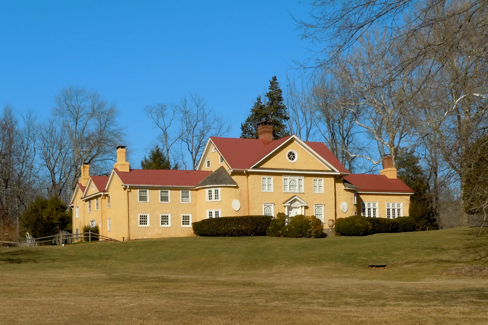
Two-story yellow mansion with red roofs on a lawn, framed by bare trees in Hibernia Park.
The former ironmasters’ home at Hibernia, photographed in its county park setting by Smallbones in 2011. Image credit

A shared landscape, a continuing story

Some of the places we enjoy most were preserved because people chose to act. Chester County formed a parks board in 1958 and purchased its first parkland in 1962. Nottingham County Park followed in 1963; Hibernia and Warwick became other important parts of the system. Former working landscapes gained new lives as places to walk, learn, gather, and encounter the natural world. A visit to Hibernia can bring recreation and industrial history into the same afternoon.

Conservation also grew through private initiative. The Brandywine Conservancy began in 1967 amid concern over proposed industrial development near Chadds Ford, now in Delaware County. Its work crosses modern county lines, following a landscape that does too. Conservation easements allow landowners to protect land while continuing to own and use it. That helps explain why a preserved farm may remain a working, private property rather than become a public park.

In 1989, Chester County voters approved a $50 million open-space bond referendum by a wide margin. The vote made land protection a shared investment. Parks and trails serve daily life; protected fields and woodlands help retain the character that draws people to the county. Their future depends on continuing choices about development, farming, conservation, and access.

The record itself needs care. Chester County Archives opened in 1982 through a partnership between the County and the Historical Society, bringing dispersed records back into county custody. Deeds, court papers, registers, and other documents allow later generations to recover names and challenge familiar stories. Museums, tribal histories, local historical organizations, and families add other kinds of memory. Together they keep the county’s history open to discovery.

There is much here to be proud of: the endurance of the Continental Army, the skill of ironworkers, the imagination of farmers and artists, and the determination of people who widened the meaning of freedom. There is also more to understand. Carrying the whole story forward is a form of care for Chester County, for Pennsylvania, and for the American promise to which this place has contributed so much.

Follow a thread

Small moments. Lasting echoes.

Open a date to see what happened.

54 moments to explore

  1. Land & farmingLenape homelands and living communities

    Long before colonial county lines, Lenape communities farmed, fished, hunted, traded, and practiced diplomacy across the Delaware Valley. Eastern Pennsylvania remains part of Lenape ancestral homelands. Forced removal carried many communities westward, but living Lenape Nations and families continue their histories today. Their own accounts connect this landscape to a wider story of sovereignty, language, memory, and belonging.

    Read Delaware Nation’s history ↗A living tribal voice on regional homelands and history.

  2. Community & changeChester County established

    Pennsylvania’s official archive lists Chester among the original counties established in November 1682. That colonial county covered a much larger area than today’s Chester County, including places later assigned to other counties. Reading old deeds, court papers, or family records therefore requires attention to the date and location: “Chester County” on an early document does not necessarily refer to a place within the modern county boundary.

  3. Community & changeThe first Assembly meets at Upland

    Pennsylvania’s first Assembly met from December 4 through 7, 1682, at historic Upland, renamed Chester. The town was then in Chester County and is now in Delaware County. Representatives began shaping the colony’s laws and institutions in a place whose political history already included generations of Lenape leadership and diplomacy.

    Historic Upland, present-day Chester ↗The place name and county geography changed after 1682.

  4. Community & changeAn early record names the Court of Chester

    The Chester County History Center identifies a surviving record in which the clerk used “Court of Chester for County of Chester” instead of “Court of Upland.” County government record; terminology reflects the period’s changing institutions.

  5. Community & changeLancaster County separates from Chester County

    Lancaster County was formed from the western part of the original Chester County in 1729. The separation reduced the territory administered from the older county seat and began a series of changes that produced the modern county map. For genealogists and local historians, the date is a useful reminder that records can follow a place’s former county jurisdiction rather than its present-day address.

  6. Land & farmingThe Walking Purchase dispossesses Lenape communities

    The Penn family used a disputed day-and-a-half walk to claim a vast tract of Lenape land, exploiting a written agreement in ways Lenape leaders had not accepted. Delaware Nation describes the episode as a fraudulent land grab that contributed to forced removal from eastern Pennsylvania. The consequences reached well beyond the county’s later boundaries and remain part of Lenape memory and political history.

    Lenape homelands in eastern Pennsylvania ↗Regional dispossession; not a county-only event.

  7. Revolution & battlesBattle of Brandywine

    Washington positioned the Continental Army along the Brandywine to block the British approach to Philadelphia. On September 11, a wide flanking movement led by Charles Cornwallis struck the American right as other British and Hessian troops pressed the front. The Americans retreated, but the army survived to continue the campaign. Today’s battlefield landscape crosses Chester and Delaware Counties, including Chadds Ford.

    Brandywine battlefield landscape ↗Battlefield geography crosses present jurisdictions; Chadds Ford is now in Delaware County.

  8. Revolution & battlesThe Battle of the Clouds is interrupted by rain

    British and American forces moved toward another engagement near Malvern, but a torrential storm soaked the armies and their powder. The encounter later called the Battle of the Clouds was brief and inconclusive; Washington withdrew rather than fight with unreliable ammunition. The weather that interrupted a military action also made already difficult marches and supply work harder for soldiers and nearby households.

    Malvern-area campaign landscape ↗The event is a regional campaign action, not a modern park boundary.

  9. Revolution & battlesA night raid at Paoli

    On the night of September 20–21, British troops led by Charles Grey surprised Anthony Wayne’s encampment near Paoli. Grey ordered a bayonet attack, and American troops suffered heavy losses. Wayne, a native of Easttown in Chester County, was fighting close to home. Patriots called the attack the Paoli Massacre, and its memory became an enduring part of the county’s Revolutionary history.

    Paoli battlefield landscape ↗The historic site and campaign geography should be distinguished from later county borders.

  10. Revolution & battlesThe Continental Army encamps at Valley Forge

    Washington’s army built a winter encampment at Valley Forge after the British took Philadelphia. The site was selected for its strategic position near the occupied capital; it was not a battlefield. Soldiers and camp followers endured shortages and illness while constructing huts and defenses. Valley Forge National Historical Park now spans Chester and Montgomery Counties.

    Valley Forge National Historical Park ↗Encampment, not battle; park spans two modern counties.

  11. Revolution & battlesThe army leaves Valley Forge

    After six months in winter quarters, the Continental Army marched out of Valley Forge on June 19, 1778, heading toward the campaign that culminated at Monmouth. The departure closed an encampment, not a battle. The National Park Service’s account places it within a larger campaign for control of Philadelphia and emphasizes that the soldiers who left were a battle-tested army, despite the severe hardship of the winter.

    Valley Forge National Historical Park ↗The park spans Chester and Montgomery Counties.

  12. Freedom & reformPennsylvania enacts gradual abolition

    Pennsylvania’s gradual abolition act barred further importation of enslaved people and established a schedule for children born to enslaved mothers, but it did not immediately free people already held in slavery. Chester County’s register records enslaved residents under that legal system. The archive shows why the law’s title should not be mistaken for instant emancipation or a simple end to bondage.

  13. Community & changeThe county seat moves to West Chester

    As settlement shifted westward and the original county shrank, county government moved its seat to West Chester in 1786. Earlier records and political institutions were tied to places that now lie in Delaware County. The move helped give the newer county a lasting civic center and explains why researchers may find older Chester County records associated with historic Chester or Upland.

    West Chester ↗West Chester became county seat after earlier centers fell outside the evolving county.

  14. Community & changeDelaware County separates from Chester County

    Delaware County was established from the eastern portion of Chester County in 1789. The split created a boundary that still matters when reading the history of Upland, early county government, and later events around Brandywine and Chadds Ford. County names in old records describe the jurisdiction at the time, not necessarily the county where a modern address lies.

  15. Freedom & reformPhebe English is recognized as free

    After years of proceedings, Pennsylvania’s Supreme Court ruled that Phebe English, a Black girl held in New Garden Township, had been born free, as had her mother, grandmother, and great-grandmother. The case reveals both the persistence of slavery and the legal actions Black people and their advocates pursued to challenge it. The surviving state record includes an earlier writ from 1785 and later proceedings.

    New Garden Township ↗The ruling is preserved in state archival records; historic township geography may differ from present place descriptions.

  16. Iron & industryA forge takes shape at Hibernia

    Samuel Downing established an iron forge at Hibernia on the West Branch of the Brandywine in the early 1790s. The works grew into a complex of furnaces, forges, a rolling mill, gristmill, farm, and worker housing. Its story links industrial production to waterpower, woodland charcoal, household labor, and the families who lived near the ironworks.

    Hibernia County Park ↗Historic industrial landscape within county parkland.

  17. Iron & industryA mill is rebuilt on French Creek

    Christopher Knauer built the surviving Mount Pleasant Grist Mill around 1805 on the South Branch of French Creek, replacing an earlier mill on the site dating to the 1730s. Water-powered milling connected farms to local markets by turning grain into flour. The Library of Congress engineering survey records the structure and its industrial history.

    Mount Pleasant Grist Mill ↗The existing mill dates to about 1805; the earlier mill was a predecessor on the same site.

  18. Iron & industryBrandywine Iron Works records boiler plate

    A company ledger records a boiler-plate order at Brandywine Iron Works in December 1818. The work connected Coatesville-area ironmaking to the expanding use of steam engines, which demanded wide, dependable plates. The surviving ledger entry is a firm local date within a broader industrial transition; the museum’s larger “first in America” interpretation is presented as its reading of company records.

    Brandywine Iron Works, Coatesville ↗Historic industrial site; the cited date comes from a company ledger entry.

  19. Iron & industryCharles Brooke develops Hibernia iron works

    County heritage material associates Charles Brooke with the Hibernia iron works in the early nineteenth century. Hibernia, present-day Chester County.

  20. Iron & industryRebecca Lukens assumes responsibility for the ironworks

    When Charles Lukens died in 1825, Rebecca Lukens took charge of the Brandywine Iron Works while raising a young family. She kept the boiler-plate business operating through financial and practical challenges and helped build its reputation for quality. Her work places a woman’s business leadership at the center of Coatesville’s industrial history.

    National Iron & Steel Heritage Museum ↗The museum interprets the company’s records and Lukens family history.

  21. Freedom & reformThe Parker sisters are kidnapped

    Elizabeth and Rachel Parker, free Black sisters living in Chester County, were illegally kidnapped in 1851 and taken toward Baltimore’s slave market. Their ordeal unfolded in the era of the Fugitive Slave Act, which intensified fears of capture among free Black communities. The sisters’ case mobilized antislavery efforts and exposed how vulnerable freedom could remain close to the border with a slave state.

    Chester County ↗The sisters’ kidnapping was part of a wider regional fugitive-slave system.

  22. Freedom & reformAshmun Institute receives its charter

    Ashmun Institute received a Pennsylvania charter in southern Chester County in 1854. Founded to educate Black men, it became Lincoln University in 1866 and grew into a major institution of higher education. Its founding predates emancipation and places education within the region’s struggle over who could claim learning, leadership, and a public future.

    Lincoln University ↗University campus in southern Chester County.

  23. Iron & industryRailroad construction sets the Struble corridor’s later path

    The route later used by Struble Trail follows a former railroad corridor serving communities along the East Branch Brandywine. Downingtown and the East Branch Brandywine corridor.

  24. Iron & industryPhoenix Iron makes a wrought-iron field rifle

    Phoenix Iron Company in Phoenixville produced the 3-inch Ordnance Rifle Model 1861 from wrought iron for Union service. The unusual material and industrial process linked local metalworking to Civil War artillery. Published production totals vary among accounts, so this moment identifies the product without repeating a disputed count.

    Phoenixville Iron Company ↗Historical society and local heritage sources identify the product; output totals conflict.

  25. Iron & industryA rail section links Downingtown and Waynesburg

    The County’s account of the former New Holland line describes a Downingtown–Waynesburg section by 1861. Rail corridor later repurposed as Struble Trail.

  26. Iron & industryThe Phoenix Column enters the ironworks’ catalog

    Phoenix Iron patented and produced its Phoenix Column, a built-up wrought-iron support used in bridges and other large structures. The column joined many smaller iron segments into a strong structural form. Its design linked Phoenixville’s manufacturing skill to public works well beyond the county, including the Washington Monument, and it later became an emblem of the company’s industrial legacy.

    Phoenixville Foundry ↗The foundry site interprets Phoenix Iron’s industrial history.

  27. Freedom & reformBlack men from Chester County serve in the USCT

    Black men from Chester County enlisted in the United States Colored Troops and other regiments during the Civil War. The County Archives’ index notes that they generally did not serve in local Pennsylvania regiments and documents men across many units. Its largest identified contingent served in the 3rd USCT, but the index is explicitly an ongoing effort rather than a complete census of every Black soldier or sailor.

    Chester County Archives USCT Index ↗An evolving research index, not a complete roll of county service.

  28. Community & changeWest Chester Normal School opens

    West Chester Normal School opened to train teachers, with residential and day students beginning classes in 1871. It later became West Chester University. The school expanded the county’s educational and civic life and connected local residents to the broader Pennsylvania system of teacher preparation and public higher education.

    West Chester University ↗Institutional factbook gives the school’s opening history.

  29. Iron & industryHibernia’s ironworks closes

    Hibernia’s ironworks closed in the late 1870s as regional ironmaking and markets changed. The site’s mansion, mill, forges, and worker-related landscape outlasted the business and later became part of a county park. The closure marks the end of one industrial chapter, not the disappearance of iron and steel work elsewhere in the county.

    Hibernia County Park ↗The county preserves the site as a historic landscape.

  30. Community & changeCoatesville’s Daniel Reed veterans’ post organizes

    Black Civil War veterans organized Daniel Reed Grand Army of the Republic Post No. 599 in Coatesville in 1890. The post met in the community and gave veterans a place to sustain fellowship and public memory. Its records add a chapter of Black civic institution-building to histories that too often stop at enlistment or emancipation.

    Coatesville ↗The History Center’s collection documents the post and related women’s relief work.

  31. Community & changeFrederick Douglass speaks in West Chester

    Frederick Douglass delivered a public address at West Chester’s State Normal School on February 1, 1895, less than three weeks before his death. The local History Center identifies it as his last public speech and notes his focus on lynching. The appearance linked a national struggle against racial violence with a local audience and institution.

    West Chester State Normal School ↗The school later became West Chester University; the History Center provides the local account.

  32. Iron & industryMushrooms find a place beneath greenhouse benches

    In Kennett Square, early growers used space beneath greenhouse benches to cultivate mushrooms alongside flowers. Chester County History Center connects the practice to Italian stonemasons who had worked in local quarries. The crop grew into a specialized regional industry, later supported by research at Penn State and by a workforce whose labor remains central to production.

    Kennett Square ↗The museum account describes local mushroom history; Penn State research began in the 1920s.

  33. Freedom & reformA mob lynches Zachariah Walker in Coatesville

    Zachariah Walker, a Black man being held in a Coatesville hospital, was seized and lynched by a white mob in 1911. The case went to court, but all indicted participants were acquitted. The Coatesville NAACP’s historian-authored account also records later Black community organizing in response to threats, placing the violence alongside the resistance and mutual protection it provoked.

    Coatesville ↗Remember the victim and the failure of justice without reproducing graphic details.

  34. Freedom & reformPennsylvania adopts an anti-lynching law

    The Pennsylvania Historical and Museum Commission links national outrage over Walker’s lynching with momentum for the state’s 1923 anti-lynching law. State law; its context includes Coatesville and the national anti-lynching movement.

  35. Freedom & reformDr. Whittier C. Atkinson opens a hospital in Coatesville

    The PHMC marker report says Dr. Atkinson founded a hospital offering care regardless of ability to pay, an institution serving people facing barriers to care. Coatesville; Black medical leadership and local health care.

  36. Community & changeHorace Pippin exhibits in West Chester

    After returning to West Chester with a permanently injured arm from service in the 369th Infantry, Horace Pippin developed a painting practice that brought national attention. N. C. Wyeth and Christian Brinton helped arrange his first solo exhibition at the West Chester Community Center in 1937. Pippin became a major American artist whose subjects included Black history and memory.

    West Chester Community Center ↗Pippin’s West Chester exhibition is documented in the National Gallery of Art biography.

  37. Community & changeGay Street School ends segregation

    West Chester’s Gay Street School served Black children in a segregated school system and did not integrate until 1956. The History Center’s account notes the unequal resources available to the school and the long tenure of principal Joseph Fugett. Students and educators built a community there despite the constraints imposed by segregation.

    West Chester ↗Local museum summary; further school records can be consulted through county archives.

  38. Land & farmingChester County forms a parks board

    The County established a parks board in 1958, creating a public structure for acquiring and managing parkland. The first purchase followed in 1962, then Nottingham County Park opened in 1963. Later sites protected a range of landscapes, including former quarries, woodland, water, and industrial properties.

    Chester County parks ↗The chronology distinguishes the board’s creation from later land purchases and dedications.

  39. Land & farmingCounty makes its first parkland purchase

    The parks history records the County’s first park purchase as an early step toward a public parks system. Chester County.

  40. Land & farmingNottingham becomes the County’s first park

    Nottingham County Park was dedicated as Chester County’s first county park. Nottingham, southern Chester County.

  41. Land & farmingHibernia becomes a county park

    The County parks history records the acquisition of Hibernia as a county park in 1964. Hibernia, present-day Chester County.

  42. Land & farmingBrandywine Conservancy forms

    The Brandywine Conservancy formed in 1967 after a proposed industrial development near Chadds Ford raised alarm about the river landscape. The organization began land-conservation work in a place that now lies in Delaware County, while the Brandywine watershed crosses modern boundaries. Its story is one part of a broader regional turn toward voluntary land protection.

    Chadds Ford and the Brandywine ↗Modern Chadds Ford is in Delaware County; conservation work follows the watershed rather than county lines.

  43. Land & farmingWarwick joins the county park system

    The County parks history dates Warwick County Park’s addition to the park system to 1973. Warwick Township.

  44. Iron & industryStruble Trail dedicated

    The former rail corridor became a public hiking and biking trail named for Robert G. Struble. Downingtown and East Brandywine corridor.

  45. Community & changeChester County Archives opens

    The Chester County Archives was dedicated in 1982 through a partnership between the County and the Chester County Historical Society. The County provided space while the Society supplied professional archival expertise, and dispersed government records were returned to county custody. The Archives now helps researchers trace lives and institutions through deeds, court files, maps, military records, and other public documents.

    Chester County Archives ↗The public-private partnership opened the Archives in 1982.

  46. Land & farmingSprington Manor Farm opens as a park

    Springton Manor Farm opened to the public as a county park with its agricultural landscape and historic buildings. Glenmoore area.

  47. Land & farmingVoters approve an open-space bond

    Chester County voters approved a $50 million open-space bond referendum in 1989, reported by the County as passing with 82 percent support. The vote created funding for land protection during a period of development pressure. Bond-funded public parks and privately held land under conservation easements have different ownership and access terms.

    Chester County ↗The bond was a countywide funding decision; protected parcels have varying public-access status.

  48. Land & farmingOpen-space purchases expand public land protection

    The County’s parks chronology records expanded open-space purchases and basin projects during the 1990s. Countywide open-space program.

  49. Iron & industryChester Valley Trail reaches its demonstration stage

    The County chronology marks the trail’s demonstration phase as an early step in a regional multi-use route. Chester Valley and regional trail corridor.

  50. Freedom & reformBlack Rock Sanctuary opens

    A former river desilting basin becomes a public wildlife sanctuary and interpretive site. Schuylkill River near Phoenixville.

  51. Land & farmingWolf’s Hollow County Park opens

    The County adds a large natural area along upper Octoraro Creek to its park system. West Nantmeal Township area.

  52. Iron & industryA Schuylkill River Trail phase opens in Chester County

    The County parks chronology records an early completed phase of its Schuylkill River Trail section. Phoenixville and the Schuylkill River corridor; total mileage remains conflicted across County pages.

  53. Land & farmingExton County Park opens in a joint open-space site

    The County’s park chronology records Exton County Park opening; current County material says the developed public recreation area is only one part of the larger joint property. West Whiteland Township; distinguish the developed site from the broader ownership area.

  54. Land & farmingAgriculture remains a major land use

    The USDA counted 1,558 farms and 143,442 acres of farmland in Chester County in its 2022 Census of Agriculture. Those figures are a dated federal snapshot rather than a real-time tally. They show that farming remains a substantial presence alongside the county’s newer suburbs, laboratories, offices, and industrial employers.

    Chester County farms ↗2022 census data; later acreage and farm counts may differ.

Stay a little longer

There’s always another story.

A village built by free Black farmers. The workers behind the iron. The unexpected beginnings of a mushroom industry. Follow the people behind the dates.

Browse every local story →
  1. Hinsonville: land, farming, and a church
  2. Under the greenhouse benches: a Kennett mushroom story
  3. The farmerettes who worked Longwood land
  4. Nailer’s Row and Phoenixville’s iron workers

A place worth knowing. A story worth carrying.

Proud of where we come from.
Part of what comes next.

The strength of this county lives in people who grow, build, serve, question and care. Knowing the whole story gives us more to love—and more to carry forward, here in Pennsylvania and in the American story we share.

Go meet the county

From the collection